Travel advice
Travel advice
Travel advice
Money
Money
Money
Personal safety & security
Personal safety & security
Personal safety & security


The historic city of Arequipa is surrounded by volcanoes and is the gateway to the Colca canyon
Arequipa
BASE CAMP Peru-Travel-Co
Introduction
The city is located on the arid western slopes of the Andes at an altitude of 2325m above sea level. It is the country's second largest city and important comercial hub. Three inactive volcanoes overlook the city and create a dramatic backdrop for the beautiful colonial city center. You can explore its centuries old convents and churches along narrow cobbled streets.
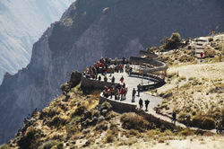
A 4-hour drive outside the city is the spectacular Colca canyon; it is one of the deepest on earth and provides visitors with spectacular vistas of deep gorges and high mountain peaks. Attractive rural villages are found along the rim of the canyon and an early morning visit to specific lookout points allows travellers to see Andean condors soaring over the steep cliffs of the canyon.
Things to do
Arequipa is known as the white city, which refers to the white tuff (ignimbrite) stone from which many of the city’s colonial buildings are constructed. In the city center, you can explore the beautiful main square and the catholic cathedral. The original structure of the church dates to 1656, but was destroyed by fire in 1844. The second building was toppled by an earthquake in 1868. The outside is impressive, but the interior is surprisingly understated, unlike other Peruvian baroque churches. Its two towers were rebuilt after being toppled in the earthquake of 1996. On the other side of the main square is La Compania Church, one of the oldest chapels in Arequipa and noted for its main facade which bears the inscription ‘Año 1698’, although the side porch dates to 1654. This Jesuit church was so solidly built; it withstood the earthquakes which destroyed other buildings. Many of its murals were painted over by 19th century restorers, but the polychrome cupola of the San Ignacio chapel is worth seeing. Nearby is the Museum of Andean Sanctuaries, which tells the story of Inca human sacrifice in the southern Andes. You will learn about arduous expeditions to the summits of nearby volcanoes to uncover the mummies of Sacrificed Inca children. On show in the museum, is the country’s most famous mummified child, Juanita, the ice maiden of Mount Ampato. Only a short walk away is the Convent of Santa Catalina, A visit takes approximately two hours and you may choose to pay for a site guide at the entrance gate. Santa Catalina is the pride of its townspeople, covering an area of more than 29,426 square meters. It is a masterpiece of colonial architecture and houses some of the finest examples of Spanish American religious art. Founded in 1580 under the rule of Viceroy Toledo, the Private Monastery of Nuns of the Order of Santa Catalina of Sena was opened to the world nearly 400 years later, in 1970. Since then, visitors have been able to stroll through the streets and cloisters, unchanged by time and imagine the life of the women separated from the outside society, often for their entire lifetime. The ochre and blue colours of its streets and patios named after Spanish cities are decorated with bright flowers such as scarlet geraniums. On the far side of the river you can visit the Recoleta Convent, built in 1648 by the Franciscans missioners, they were amongst the most active of the Catholic missionaries. Study and education played a large part in their activities and the massive library contains over 20,000 books, many of which are centuries old. They also have a museum of Amazonian exhibits collected by their missionaries while attempting to convert the natives. A short walk from here is the suburb of Yanahuara, with a pleasant plaza and spectacular views over the city and surrounding volcanoes.
As well as attractions in the city, it also acts as a gateway to the spectacular Colca canyon. The Peruvian novelist and nobel lauriet, Mario Vargas Llosa, called the Colca Canyon the "Valley of Wonders"; it's hard to disagree. It was declared the deepest canyon in the world by the Guinness Book of Records in 1984; it's twice as deep as the Grand Canyon. Although in recent years, the nearby Cotahuasi canyon has been found to be 163m deeper. The Canyon has been inhabited since prehistoric times and several stone age sites have been discovered in the valley. Settlement in earnest began in the pre-Inca period when the Collagua and Cabana groups started to carve terracing out of the hillsides. It is a testament to their skill and ingenuity that, 1,400 years later, farmers are still using and maintaining these original terraces to produce the staple crops of the region. Like every other ethnic group in the region, the Collagua and Cabana were eventually either conquered by the Incas or scattered into the far reaches of the Canyon. The Incas attached great ritual significance to the area, as they continued to build terraced fileds and settlements. After the conquest, the Spaniards also recognised Colca's importance and ordered what was left of the canyon's population after years of war and disease to be gathered into fourteen villages in the valley to make agricultural exploitation and tax collection easier. If this sad episode in the canyon's history can be said to have had a silver lining, it lays in the fourteen churches of the valley, each a unique example of the blending of European religion and architecture with those of the inhabitants' ancestral traditions."A visit to the canyon is a breathtaking experience; as you can look down to see the Colca river hundreds of metres below the edge. The canyon is flanked by several volcanoes, including Mismi, Ampato and Sabancaya, from which smoke can sometimes be seen rising from its crater. You will see the great amphitheatres of pre-Inca terraces and charming rural villages with colonial churches. At the Cruz del Condor, a highlight of any visit is the sight of Andean condors soaring on the morning thermals above the steep walls of the colca gorge.
Travel over the Andes on the Andean Explorer train, sleeping at a remote high altitude lake.

Where to eat
In Arequipa, there are plenty of places to eat overlooking the main square, you can enjoy the view but the quality of food might not be great. Otherwise, many restaruants are concentrates in San Francisco and Santa Catalina streets just a few blocks north of the main square . Below are some suggestions for places to eat in Arequipa, You may find menus and can book tables online using some of the links below;
ZIG-ZAG has delicious dishes with an emphasis on local meats.
CHICHA serves Peruvian classic dishes in a contemporay style.
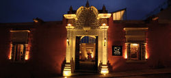
TRATTORIA DEL MONASTERO and italian bistro in a lovely old building.
EL TIO DARIO is a great place on a lunchtime for good seafood in a rustic outdoor restaurant a short drive from the city center.
ZINGARO has lots of meat and fish with typical peruvian flavours
DIMAS serves refined Peruvian and international dishes
HATUNPA is a small cafe that provides a chance to try a variety of local patato dishes.
CHELAWASI is a small bar serving craft beers and snacks
LAS GRINGAS serves good artesanal pizzas and a variery of drinks.
Climate
Arequipa has an enviable 300 days of sunshine every year. With average daytime temperatures of 22°C and dropping to around 7°C at night. The only exception are the months of December through March, when the skies can be partially overcast with light showers. The Colca canyon is realtively close but much higher in altitude, so the nights are much colder, with nightime temperatures dropping to below O°C.
History
At 2325 meters above sea level, Arequipa is a city of the highlands, rather than the coastal desert, with a long a varied history. There is archaeological evidence of pre-Inca settlement by Aymara indians from lake Titicaca and some scholars consider that it was the these who named the city. In the Aymara tongue, the name can be roughly translated as the “behind the mountain”, probably referring to the volcano Misti. Others attribute the name to a later Inca language, which can translate Arequipa as “yes, stay”. Spaniards invaders founded the colonial city on 15 August 1540 and this date is still commemorated by a week-long fair in the city. But unfortunately, it is built in an area highly prone to earthquakes and throughout its history the city has constantly had to be rebuilt. The entire city was destroyed in the earthquakes and volcanic eruptions of 1600. Other major earthquakes occurred in 1687, 1868 and more recently in 1958, 1960 and 1998. The city is surrounded by volcanoes, none of which are active but they provide a dramatic backdrop to the city. The most famous of which is the Misti, it dominates the skyline when looking from Arequipa, its peak is measured at 5822 meters above sea level. To the left of Misti, is the ridge of ‘Chachani’ measuring 6075 meters and to the right is the lower peak of ‘Picchu Picchu’ (5669m). A distinctive feature in the historic city center is the white volcanic rock that most of the older buildings are made from. It is locally known as sillar and it gives the town its nickname of the White City. The current population of Arequipa is about 1million people, making it Peru’s second city. It is a thriving commercial hotspot, with a thriving industrial sector and rich mineral reserves allows it to attract many international mining concessions.
 |  |  |
|---|---|---|
 |  |  |
 |  |  |
 |  |  |
 |  |  |
 |  |  |